Helios APIs: Alerts (Search), Cameras (Index), Cameras (Live), Observations (Index)
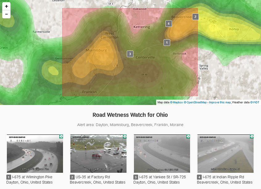
We can use the location data provided with each alert as inputs to other APIs to find related resources, such as live camera imagery or current observation data.
To begin, we query the Alerts API to identify alerts based
by text, event type, location, or time. A bbox and
geometry attribute is included for each alert
included in the API response.
https://api.helios.earth/v1/alerts?q=flood
To find cameras in a given alert area, we can query the Cameras
API and supply a bbox query parameter using the alert's
bounding box. Assuming an alert bbox value of
[-84.375, 39.550, -84.023, 39.726], our camera
query would be:
https://api.helios.earth/v1/cameras?bbox=-84.375,39.550,-84.023,39.726
We can then use the camera IDs returned by the camera query to request live imagery for each camera, e.g.
https://api.helios.earth/v1/cameras/OHDOT-240206/live
We can also query for current observation data in the alert area using the same approach we used for querying cameras, except this time we use the Observations API instead of the Cameras API. To search for indvidual observation points, our query would be:
https://api.helios.earth/v1/observations?bbox=-84.375,39.550,-84.023,39.726
If we are more interested in trending or summary data rather
than individual observations, we can modify our observations
query to request aggregation data. Let's assume that we are
only interested in recent observations where wet roads were detected.
We can use the bbox, sensors[road_weather],
and aggs query options to search for wet road
observations in the alert area and aggregate the results by time:
https://api.helios.earth/v1/observations?bbox=-84.375,39.550,-84.023,39.726&sensors[road_weather]=3&aggs=time